Dataset describing the locations of 1643 Denny's Restaurants in the United States. Each observation corresponds to one restaurant, with restaurant information scraped from https://locations.dennys.com/. The process used to obtain the geographic data is described in a blog post here http://njgeo.org/2014/01/30/mitch-hedberg-and-gis/.
dennysFormat
A tibble with 1643 rows and 6 variables:
- address
Street address of the restaurant.
- city
City of the restaurant.
- state
US State of the restaurant.
- zip
US ZIP Code of the restaurant.
- longitude
The longitude of the restaurant. in degrees.
- latitude
The latitude of the restaurant. in degrees.
Source
https://github.com/johnjreiser/HedbergGIS
Examples
library(ggplot2)
library(dplyr)
#>
#> Attaching package: ‘dplyr’
#> The following objects are masked from ‘package:stats’:
#>
#> filter, lag
#> The following objects are masked from ‘package:base’:
#>
#> intersect, setdiff, setequal, union
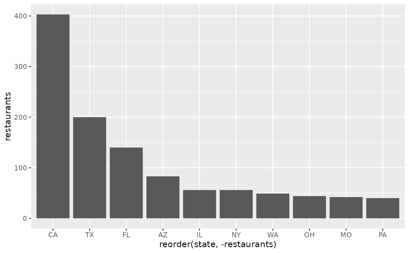
dennys |>
group_by(state) |>
summarise(restaurants = n()) |>
arrange(desc(factor(restaurants))) |>
slice_head(n = 10) |>
ggplot(aes(x = reorder(state, -restaurants), y = restaurants)) +
geom_col()